Maps - County
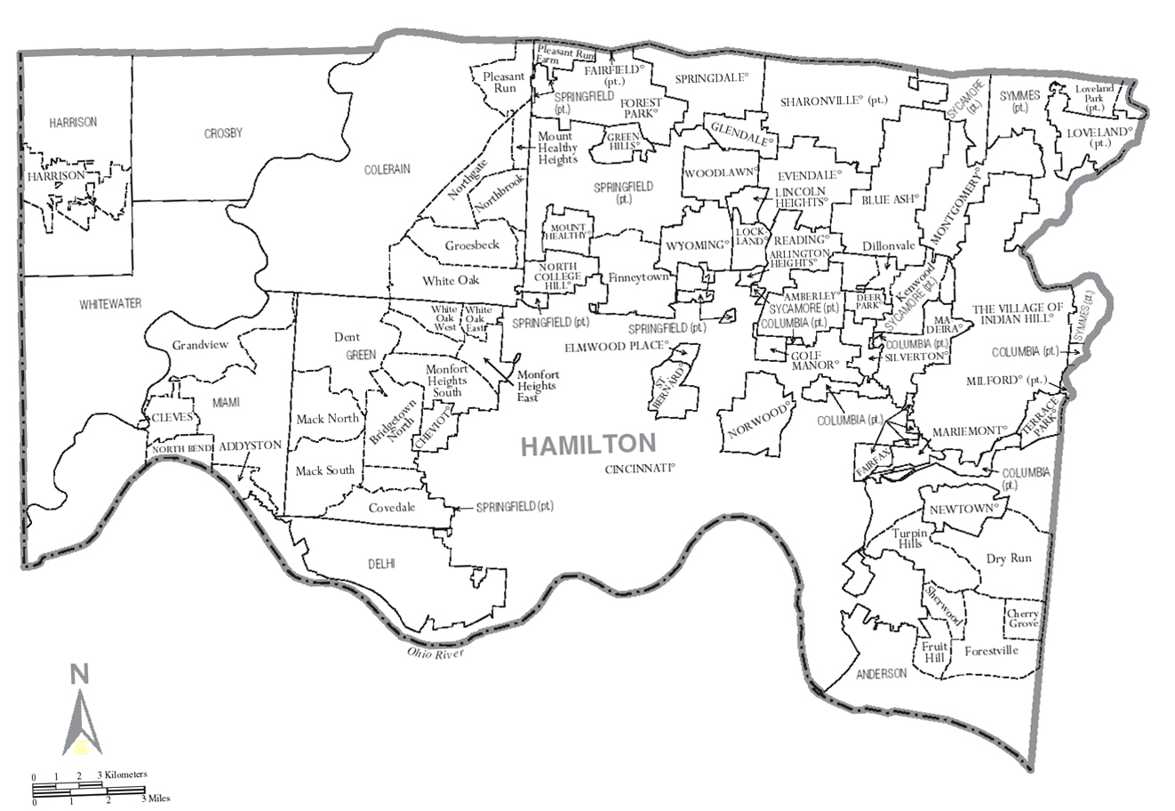
Current County Map
Hamilton County cities, towns, townships and unincorporated areas today
Click above map to enlarge.
Townships and Surveys
Hamilton county Ranges, Towns and Sections in 1853
The land in Hamilton County has been surveyed three different ways in three separate areas - Symmes purchase between the Miami rivers, government survey next to Indiana border and Virginia Military warrants in Anderson twp. (see above). To trace property in the county, it is necessary to understand the nomenclature of how the townships and sections are arranged and identified. This 1853 map illustrates the Range-Town-Section arrangement in Hamilton County.
Ranges, Entire Ranges and Fractional Ranges
Today's townships are 36 section squares arranged in areas called Ranges. Governement survey entire Ranges were west of the Great Miami River, with surveyor Ludlow's entire Ranges and fractional Ranges east of the Great Miami River. Within the Ranges, a smaller grouping of sections was designated as Towns. This term has nothing to do with actual existing named towns, villages and cities within the county today. History and excellent in depth summary is in The American Surveyor professional journal.
Israel Ludlow survey naming system of Ranges, Towns and Sections of Hamilton county map
Hamilton County map showing Ranges, Towns, Sections, roads, creeks, etc. to locate from ancestors deed Range - Town - Sections designations available here.
Towns
Within the Ranges were towns, numbered from 1 to 5. For areas not next to rivers or county boundaries, ideally there would be 36 sections to a Town, arranged in a 6 section by 6 section square. Because of the rivers and boundaries, some Towns contain a varied number of Sections.
For example: to describe the area from the Indiana border to the Great Miami River:
| Range |
Town |
Township |
Sections |
| no. 1 East |
1 |
part of Whitewater |
# 1 to 12, 15 to 22, 29 to 31 |
| no. 1 East |
2 |
part of Whitewater and part of Harrison |
# 25 to 27 (Whitewater), # 4 to 6 (Harrison) |
| no. 2 East |
1 |
part of Whitewater and east side of Crosby |
# 6, 7, 31 (Whitewater), # 3 to 9, 16 to 18 (Crosby) |
The current Townships can be described by what surveyed lands are contained within them:
| Township |
Year created |
Description as used to this day |
| Colerain |
1794 |
ER1 T1, also ER2 T1 and ER1 T2 |
| Springfield |
1795 |
ER2 T2 and ER1 T3 |
| Sycamore |
1803 |
ER2 T3 and ER1 T4 |
| Symmes |
1820-1826 |
ER2 T4 and ER1 T5 |
Historical County Maps
County maps 1835 to 1937
Many detailed maps have been published to help you with your ancestral research. Knowing where they lived helps understanding the life they lived, on a farm or in town, access to rivers or roads, neighbors that may have become close friends, in-laws or even increased their property when the neighbor died or "moved west".
Bill Graver, a dedicated member of our Society, produced several books to help you with county land and maps, available at county libraries (CHPL) or purchased in our Shop. See the Shop listing for details of their contents.
Hamilton County, Ohio, Index of People, Roads, Churches, etc. on 1835, 1847, 1848, 1869, and 1884 Maps & Atlases
Cincinnati, Ohio, Index to Property Owners & Streets in 1895 & 1897 Atlases
Hamilton County, Ohio, Guide to Recorder's Indexes and Documents, 1794-1988
Hamilton County, Ohio, Index to Early Deed Books, 1804-1806 and 1814-1817
The Library of Congress (LoC) has many apparently original copies in good condition that they have scanned in very high resolution available online that enables you to read your ancestors and their neighbors names. The direct url link and instructions on how to copy the entire map or to easily clip just their actual properties, boundaries and names of the owner at the time it was published.
 Columbia twp. sec 30-> Columbia twp. sec 30-> 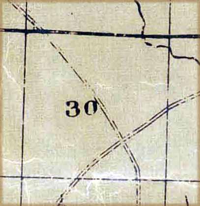 1835 Hamilton County Ohio from actual survey by Morrison and Williams.
 Columbia twp. sec 30-> Columbia twp. sec 30-> 
1847 Map of Hamilton County, Ohio by Wm. D. Emerson. Includes insets of Sharon, Elizabethtown, Cleves, Mt. Pleasant, Miamitown, Harrison, Springdale, Mt. Auburn, Cummingsville, Newtown, Lockland, Columbia, Reading, Montgomery, Walnut Hills, and Carthage.
CHPL: 912.77177 fE53
use setting symbols on map at upper right: + or - or full screen or use mouse wheel to enlarge enough to read names etc.
Instructions to define area of interest, clip, select, download just land that you want like the enlarge clip above.
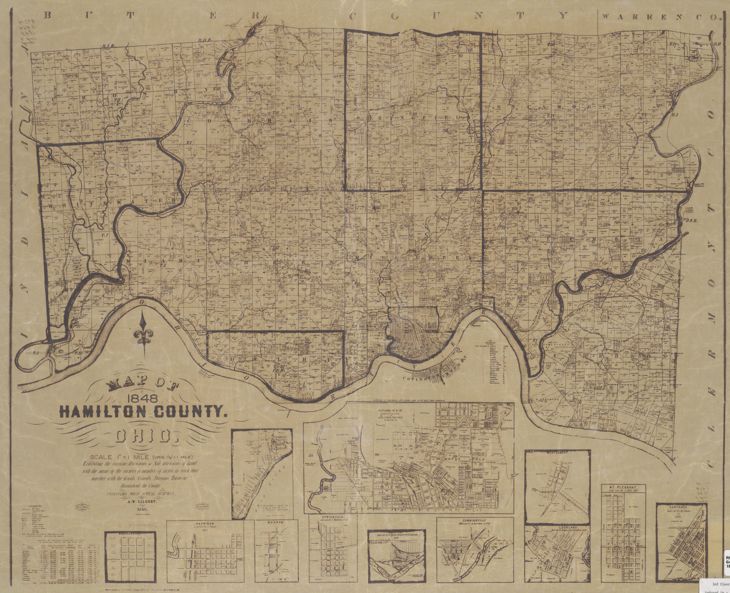 Columbia Twp. Sec. 30 -> 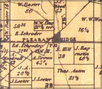 1848 Map of Hamilton County, Ohio : by A.W. Gilbert: exhibiting the various divisions & subdivisions of land with the names of the owners & number of acres in each tract, together with the roads, canals, streams, towns & c. throughout the County. Inset maps of Madisonville, Harrison, Sharon, Springdale, Montauk, Cumminsville, Lockland, Montgomery, Mt. Pleasant, and Carthage.
 Columbia Twp. Sec. 30 ->  1856 Map of Hamilton County, Ohio : exhibiting the various divisions & subdivisions of land with the names of the owners & number of acres in each tract, together with the roads, canals, streams, towns &c. throughout the County / compiled from actual surveys by A.W. Gilbert,
CHPL: 3rd floor Ref: 912.77177 G464
LOC: http://hdl.loc.gov/loc.gmd/g4083h.la000633 then scroll down to entire map, use setting symbols
at upper right + or - or full screen or use mouse wheel to enlarge enough to read names etc.
Instructions to define area of interest, clip, select, download just land that you want.
circa 1860, Hamilton County map (by George Kattenhorn?), showing Township names, Section numbers, Range and Town identification. Original on wall at Hamilton Co. Recorder's Office. images: 1860 west half 1860 east half
CHPL: 3rd floor map cabinet:
1869 - Hamilton County, Ohio. Outline townships & sections map / C. O. Titus' Atlas of Hamilton Co., Ohio
CHPL: 3rd floor map cabinet
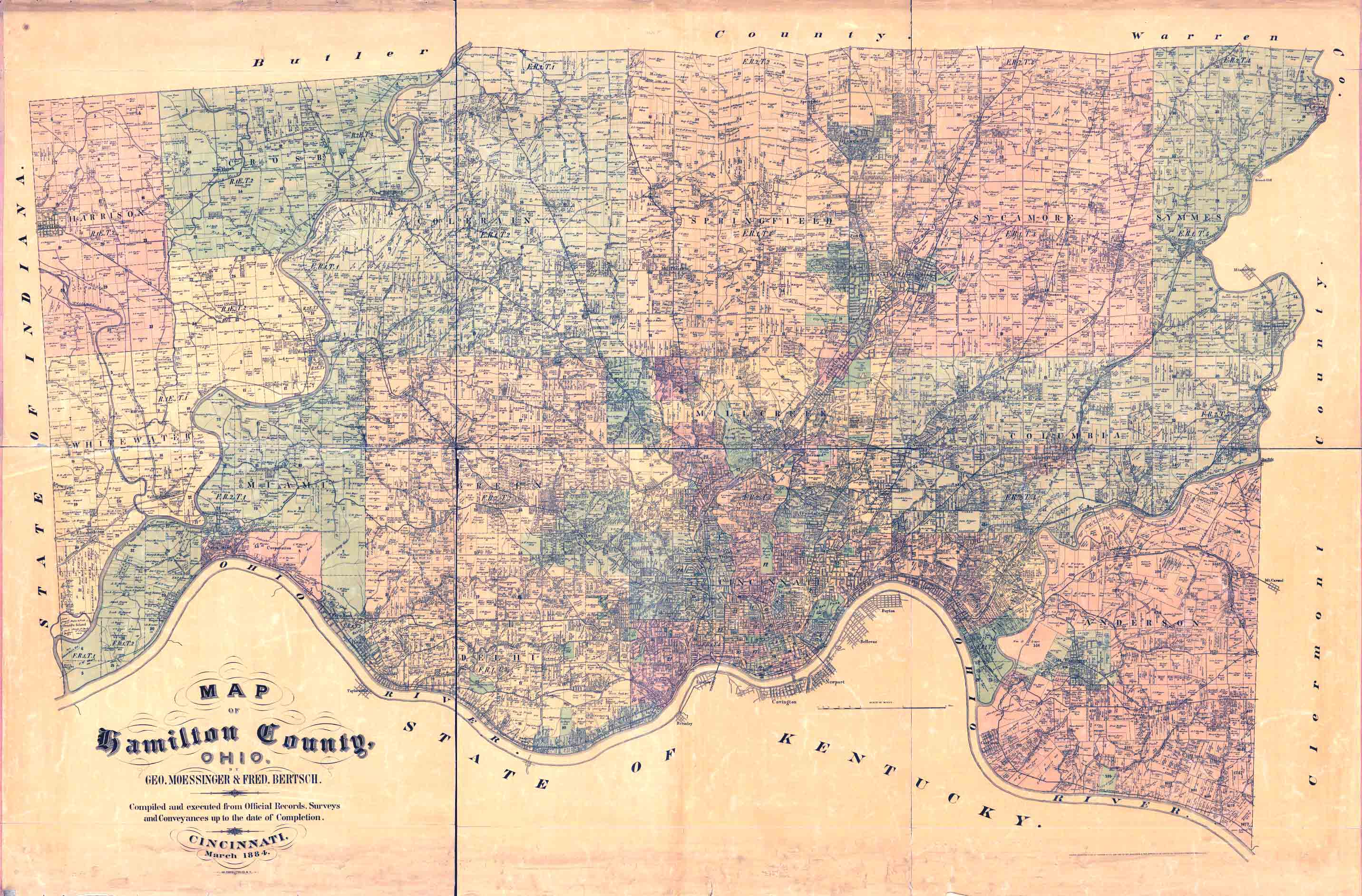
1884 - G.W.Moessinger property owner map. At Library of Congress. Can enlarge, clip and download ancestral land.
 enlarged area of Pleasant Ridge -> enlarged area of Pleasant Ridge -> 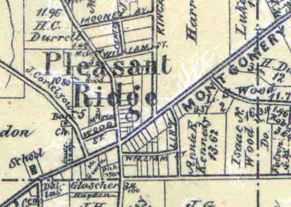
symbols at upper right, + or - or full screen or use mouse wheel to enlarge enough to read names etc.
Instructions to define area of interest, clip, select, download just land that you want.
1914 - C. S. Mendenhall's Standard map of Hamilton County, Ohio : compiled from government, county & city surveys
CHPL: 3rd floor Ref: 912.77177 M537
1914 - Cincinnati maps, by Stewart Map Company,
CHPL: 3rd floor map cabinet
CHPL: https://digital.cincinnatilibrary.org/digital/collection/p16998coll9/id/4385/rec/7
Three very extensive Cincinnati map collections are available online:
Detailed lists of Hamilton co. maps and where they can be seen is covered in: Cincinnati Maps, 1792-2017, descriptions and sources, The Tracer, June 2018, page 33 and Hamilton County Maps, 1835-2017, descriptions & sources, The Tracer, March 2018, page 1
Resources
- Jim Dempsey, "Hamilton County Recorder - Connecting Deeds & Leases to Plats", The Tracer, March 2017
- Jim Dempsey, "Speculators, Surveys and Deeds - Hamilton county land history", The Tracer, March 2017
- Jim Dempsey, "Hamilron County Maps, 1835 - 2017", The Tracer, March 2018
6Sep2023: JGD
|

